A short historical outline
It is about the part of Imathias plain flown by the Aliakmonas River. This region extended from the northern foot of Pieria as far as the Marsh of Giannitsa and from the knolls of Veria as far as the river Kara Asmak (Loudias River) and Aliakmonas’ river mouth in the Thermaic Gulf, whilst many assume it reached down to the Axios River.
It was named Roumlouki by the Ottoman conquerors (14th-15th century). When they invaded the region and discovered the unadulterated Greek population they named this area Rumlik-Roumlouk or Ouroumlouk, a Turkish word originating from the word Rum=Greek and the attribute –lik (-louk), so that it would mean the region with Greek Christians, descendent of the Romans. In other words, it means the place with many Greeks, the land of the Greeks.
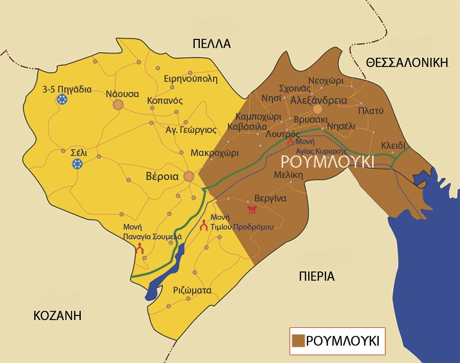
Roumlouki consisted of the following villages: Gidas (Alexandreia), Meliki, Koryfi, Shoinas, Nichori, Resina (Vrysaki), Nisi, Katafygi, Trichovista, Skylitsi, Kavasila, Stavros, Xechasmeni, Rapsomaniki, Pozarites (Kefalochori), Episkopi, Loutros, Kapsochora, Paliochora, Niseli, Niseloudi, Trikala, Karya, Aidonochori, Platy, Lianovergi, Paliochori, Gritzali, Niochoropoulo, Prodromos, Niokastro, Voultista, Megalo Alamporo, Mikro Alamporo Mylovos, Kouloura, Diavatos, Mikrogouzi (Makrochori), Metsi (Mesi), Ammos, Santena, Geraki, Mavrangeli, Mparmpes-Koutles (Vergina), Trichlevo (Trilofia), Sfinista, Klidi, Kaliani (Aloro), Tsinaforo (Platanos). The number as well as the position of the villages was not always stable as many of them were left uninhabited or rebuilt in new positions due to Aliakmonas’ frequent floods.
Alexandreia of Imathia
Ioannis D. Moschopoulos
Lawyer
Researcher of History and Folklore